How to Use the Dronecast App
Use this guide to explore the features of Dronecast and make the most of its tools for safe and efficient drone flying. Jump to a section below to learn more:
Contents
- Forecasts and Flying Conditions
- Satellite Visibility and KP Index
- Customising Your Experience
- Staying Informed
Forecasts and Flying Conditions
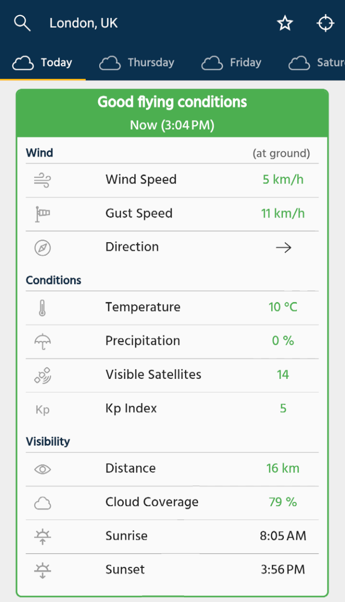
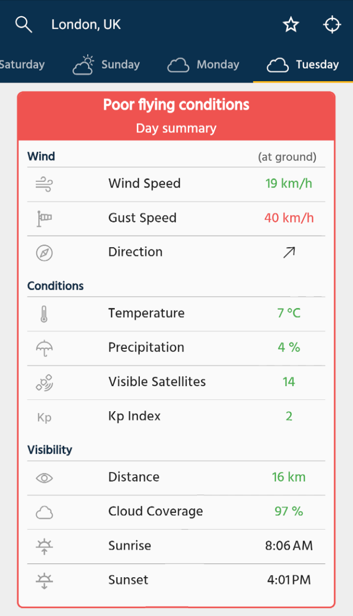
The Forecast page provides a clear report indicating either Good or Poor flying conditions.
Each condition such as wind speed, gust speed, and precipitation (chance of rain or snow) is displayed with color-coded indicators. If any condition is marked in red (e.g., high wind speed), the overall status is shown as Poor Flying Conditions. Conversely, if all conditions are marked in green, Good Flying Conditions are indicated.

E.g. Good flying conditions

E.g. Poor conditions due to high gust speeds
Satellite Visibility and KP Index
When flying a drone, your GPS navigation system relies on satellites for accurate positioning, which is essential for stable flight, precise navigation, and maintaining a reliable connection to the home point. Issues with satellite signals can lead to inaccurate positioning, unstable flight, or even losing the drone.
Our app shows the number of visible satellites, predicting those your drone’s GPS can detect. However, not all visible satellites will be locked onto or used for navigation. Obstructions like buildings and trees, as well as solar activity, can disrupt signals. To help pilots assess potential disruptions, we also display the KP Index, which measures geomagnetic disturbances caused by solar activity. High KP Index values can degrade GPS performance, affecting flight stability and accuracy.
To minimize these risks, monitor both the visible satellite count and KP Index in the app, fly in open areas, avoid periods of high solar activity, and allow your drone time to establish a strong GPS connection after takeoff. Additionally, drones support different navigation systems (e.g. GPS, GLONASS, Galileo, BeiDou), which you can enable or disable in our app settings based on your drone’s capabilities and conditions.
Customising Your Experience
In the Settings page, you can change the safety thresholds for conditions like wind speed or precipitation to suit your specific drone model and flying preferences.

E.g. Configure max wind speed
Staying Informed
Our data is frequently updated to provide the most current conditions for your planned flights. By understanding and utilizing these features, you can ensure safer and more enjoyable flying experiences with your drone. Always adhere to local regulations and be mindful of changing weather conditions.